
Johnston Neighbors Block Record Sources
Public records can describe a block from several angles. MapClick is the current spatial source. The tax record identifies the parcel owner and separate mailing and physical-address fields. A recorded plat or deed supplies the legal description and rights-of-way. Hill city directories place names in historic street order. The voter route is a registration record, not a parcel record. Taken together, these sources can describe adjacent tax parcels, nearby historic street numbers, and civic geography without turning a map into a list of household relationships.
| Source | What it shows about a block | Access |
|---|---|---|
| MapClick buffer | Adjacent parcel polygons, nearby names and addresses, layers, and buffer radius | Public GIS; checked results can export to CSV |
| MapClick street query | Street name and address range | Public GIS; address database may be incomplete |
| Tax parcel data | Owner, mailing address, situs, value, and parcel details | Tax portal and MapClick; county accuracy caveat |
| ROD plat or deed | Lot, subdivision boundary, right-of-way, and legal neighbors | Public online record search and office route |
| 1963 Hill directory | Street-number order, both sides, intersections, and directory lines | DigitalNC historical scan |
| Voter street arrangement | Registration fields grouped by street when requested | County request form, fees, processing time, and protected-address limits |
| Clayton maps and notices | Town boundary, zoning, development, utilities, and nearby-project context | Official municipal routes for Clayton addresses |
Call the result by its source: “adjacent tax parcel,” “street-number neighbor in the 1963 directory,” or “nearby MapClick parcel.” A map label is not proof that the owner lives there, and a directory line is not a present-day claim.
MapClick Buffer for Johnston Neighbors
Johnston County MapClick has the most direct current method for a block query. Its manual describes Select Buffer Area: enter a buffer size, submit it, click the subject parcel, and inspect the surrounding parcel list. Nearby parcel names and addresses can be checked and exported to CSV. For a careful record, display the subject parcel, parcel boundaries, street layer, and nearby owner or address labels. Exact layer dates vary, so the capture should carry a lookup date.
The official Johnston MapClick manual documents the buffer and output controls.
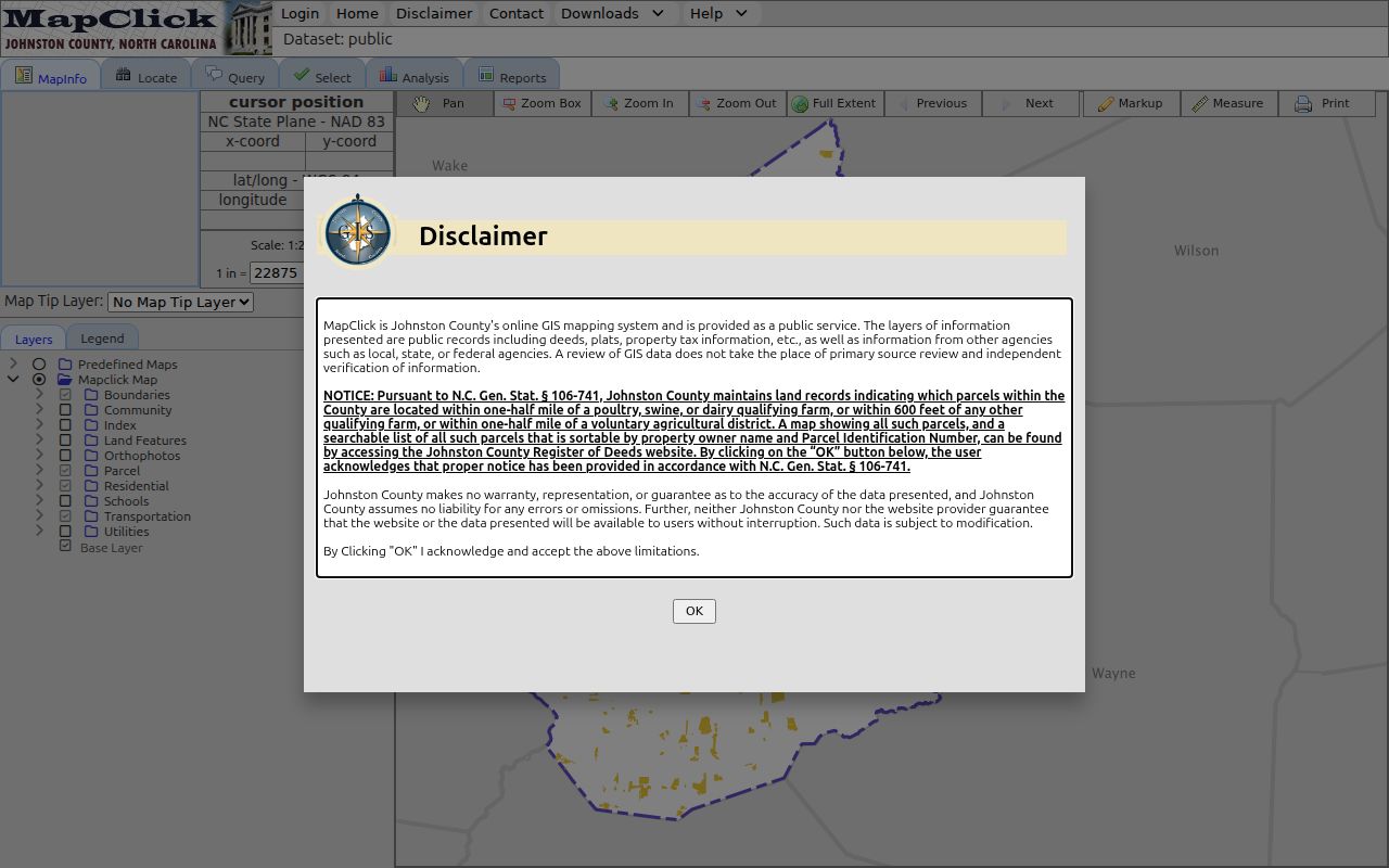
The MapClick screen is a locator, not a personal roster. Match the clicked parcel to its PIN, mapsheet, and deed book/page before drawing an ownership conclusion. If the address search fails, try a partial street, remove a directional or suffix, use the PIN, or select the road from the map. The county says the address database is incomplete, and a street-only search may zoom to the full street.
- Locate the subject address or PIN in MapClick and open the returned parcel information.
- Turn on parcel boundaries and street layers, then note the PIN, mapsheet, physical address, and deed book/page.
- Choose Select Buffer Area, enter a reasonable radius, submit, and click the subject parcel.
- Inspect each checked parcel as its own record, retaining the owner field and mailing or situs label exactly as shown.
- Open the recorded deed or plat when the legal boundary, lot, or right-of-way matters more than visual proximity.
Johnston Neighbors Address Labels
A MapClick or Tax result can show an owner field, a mailing address, and a physical or situs address. Those are three separate fields. A situs address is the physical parcel location. A mailing address is where tax correspondence goes. The owner field identifies the tax account’s listed owner. None of them alone proves that a particular person currently occupies the parcel. A multi-unit record and an individual unit record can also differ.
- PIN
- The North Carolina parcel identification number used to anchor a parcel across MapClick, tax, and recorded-document work.
- Mapsheet
- The map reference attached to a parcel record, useful when a long rural road crosses several communities.
- Situs address
- The physical address assigned to the parcel, distinct from an owner’s mailing address.
- Legal description
- The deed or plat language that identifies the land; it is stronger boundary evidence than a screen location alone.
For rural roads, compare the MapClick township, municipality, and ETJ fields with the USPS city and ZIP. A postal community may not be the nearest incorporated town. When two addresses appear to share one parcel, use the tax-card building information and permit route cautiously rather than assuming separate households.
Note: Preserve each field label in notes so a mailing destination is never mistaken for the parcel’s physical location.
Johnston Neighbors Voter-List Request
The ordinary voter lookup can confirm a submitted name, but it is not a street export. Johnston’s voter-data request form offers street and walking-list arrangements, along with precinct and ward options. It permits requests for voter registration, voter history, or voter statistics and lets a requester narrow the geography to a municipality, county commissioner district, Board of Education district, precinct, ward, or listed legislative district.
The form can request selected public fields such as physical address, mailing address, age or age range, party, race, gender, active or inactive status, and phone. It also allows history by primary, second primary, general, municipal, or runoff election with a selected year. Johnston lists 15 cents per printed sheet, 40 cents per label sheet, $10 for USB, and email delivery free. Full payment is required before processing, and the stated minimum is five business days.
Insider tip: select the narrowest geography and the minimum fields needed for a civic-record question. The public lookup’s exact refresh date is not stated, and an absent result is only a no-match under the entered filters. Protected voter and ACP address limits remain in effect.
Johnston Neighbors in Street Order
For an earlier block, the 1963 Hill directory is the local street tool. Its street section orders buildings by number, shows both sides in one list, and identifies intersections. Read the subject number, the next lower and higher numbers, the cross street, and any gap in the sequence. Then use the alphabetical section to check the printed names. The 1957, 1959, 1961, and 1963 volumes create separated annual snapshots, not a continuous record.
The 1963 Smithfield-Selma directory record at DigitalNC is the online starting point. Compare a street-page line with the volume year and its publisher notes. The directory’s owner mark is a family-reported notation the publisher did not guarantee. A historical directory entry should be labeled with its year, not treated as a current address claim.
When a same-name question remains, the state genealogy guidance recommends using roughly 10 to 15 nearby households to establish a stable neighborhood context. The 1915 Smithfield Sanborn set can add building and intersection context, but it does not name a household. Pair it with a street page, a deed or plat, and a dated newspaper or obituary record.
Johnston Neighbors and Legal Boundaries
Visual adjacency is not always a legal relationship. A road, easement, right-of-way, or irregular tract can put two parcels close on a map while a plat describes a different boundary. After MapClick provides a PIN and current deed book/page, use the Johnston County Online Record Search for the recorded instrument. Read the document type, parties, legal description, and any referenced plat. The Register of Deeds search can lead to deeds, plats, easements, rights-of-way, and subdivision documents.
A subdivision name in GIS is a useful locator, but the plat is the legal boundary evidence. “Find Related” in the recorder search can help locate documents sharing a legal description or referring to the current instrument. Record the instrument date, book/page, description match, and map relationship. A deed is evidence of a recorded land event, not proof of a current household.
For the longer current chain along a named road, the Johnston by-street directory uses the address, tax, deed, and street layers in a broader sequence.
Clayton Community Records for Neighbors
Addresses in or near Clayton can fall into municipal records as well as county systems. Clayton’s neighborhood-meeting packet describes notice to adjacent property owners and explains how HOA property is handled in the notice process. The material identifies an affected area for a particular proposal. It is not a member directory. Clayton maps and GIS add address, zoning, town-limit, development, utility, and street-maintenance context for a block inside the town’s jurisdiction.
| Clayton neighborhood-meeting packet | Official municipal notice process for adjacent owners and HOA property; use it to identify a project’s nearby-area process, not membership. |
|---|---|
| Clayton Maps and GIS | Municipal address, zoning, town-limit, development, utility, and street context for a Clayton block. |
| Downtown Clayton Development Association Advisory Board | An official civic organization named in Clayton’s municipal code. It is an umbrella municipal association, not evidence of a private-neighborhood roster. Public meeting materials are available through the Clayton meeting portal. |
Check the situs jurisdiction before relying on a town record. Clayton’s current public meeting portal moved to the listed route on January 1, 2026, while permit and planning records can have their own date and jurisdiction boundaries.
Johnston Association Directory Gap
No centralized official Johnston County-wide neighborhood-association directory was located. That is a research gap, not evidence that a named neighborhood lacks an association. No complete HOA roster was located in the official material either. Do not create a list of association names or household contacts from parcel data, meeting notices, or indirect clues.
For a specific subdivision, search the Register of Deeds for a declaration or covenant, map the subdivision in MapClick, then check the relevant town planning or meeting record for a current project. Use only contact information publicly posted by the responsible source. Clayton’s notice packet is a practical fallback because it can show the adjacent-owner and HOA-notice process without claiming to be an association directory.
Note: A recorded covenant can establish a document trail, but it does not establish current membership, a roster, or a personal relationship.
Official Sources Versus Generic Tools
Official records are best when the question needs a source label, date, and custodian. Generic commercial neighbor tools may group names or addresses, but their update date, method, and link to the original record can be unclear. A category result is a lead only. It should never replace the MapClick parcel, Tax Administration record, Register of Deeds instrument, voter request, or dated directory that actually supports the conclusion.
| Official Johnston source | Names the custodian, record type, date boundary, field label, and a route to correct or verify a record. |
|---|---|
| Generic commercial category | May offer a quick lead, but can be stale or unverified and may not identify the source or date behind a claimed address. |
| Best practice | Keep the official URL, lookup date, PIN or book/page where relevant, and a conclusion limited to what the record actually shows. |
Privacy Limits for Johnston Neighbors
North Carolina public access is record-specific. A parcel result does not expose every household member, a voter record can be protected or outdated, and a historic directory is only a snapshot. Do not reproduce Social Security numbers, driver-license numbers, banking data, full unmasked birth dates, protected addresses, or sensitive law-enforcement detail. The Johnston Register of Deeds redaction process exists because a public document can contain an identifying number that should not be copied.
The North Carolina Address Confidentiality Program provides substitute-address protections for eligible survivors of domestic violence, sexual assault, stalking, or human trafficking. A participant can keep a voter address confidential through the Johnston Board of Elections. If an address is withheld, stop the trail. Do not combine parcel, historical, voter, or nearby-record clues to work around that protection. Use “adjacent parcel” or “directory-listed person” rather than making claims about a private relationship.
Lawful use. Use block records for personal, lawful research and keep descriptions source-specific. Never use a Johnston neighbor result to stalk, harass, intimidate, or harm anyone.